Overview
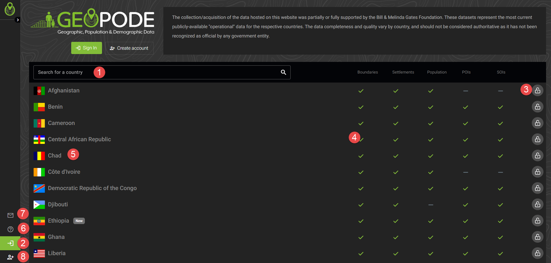
Landing page
Search for a country
Sign in to the platform
Indicates if a country is locked or available. Per default, only Nigeria is publicly accessible
The green checkmarks indicates if this type of data is available for a country
To obtain more data about a country or access the data for a country (if logged in), click on it
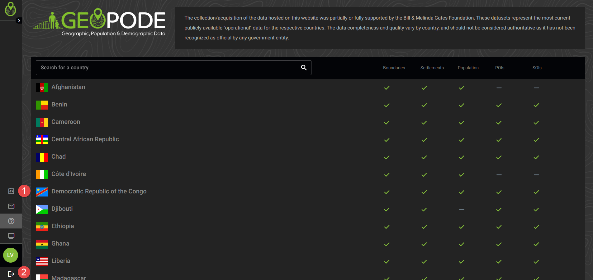
Access to the documentation
Contact information
Creation of an account
When logged in, you have an additional option:
This can be used to obtain parameters for integration with QGIS, ArcMap or other GIS desktop solutions
Logout
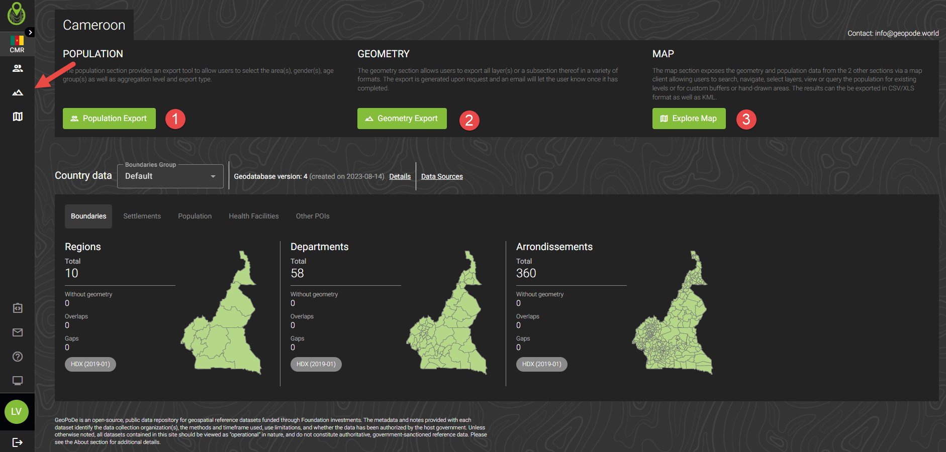
Country information
Click on a country to get more information on it (works when logged out or logged in).
Logged out
A thumbnail map showing where the respective data is available
The data sources and dates of the respective data (in the format yyyy-mm)
A summary of all data sources for a country
Version info for this country (you can click on details to obtain more information on this and previous version, if available)
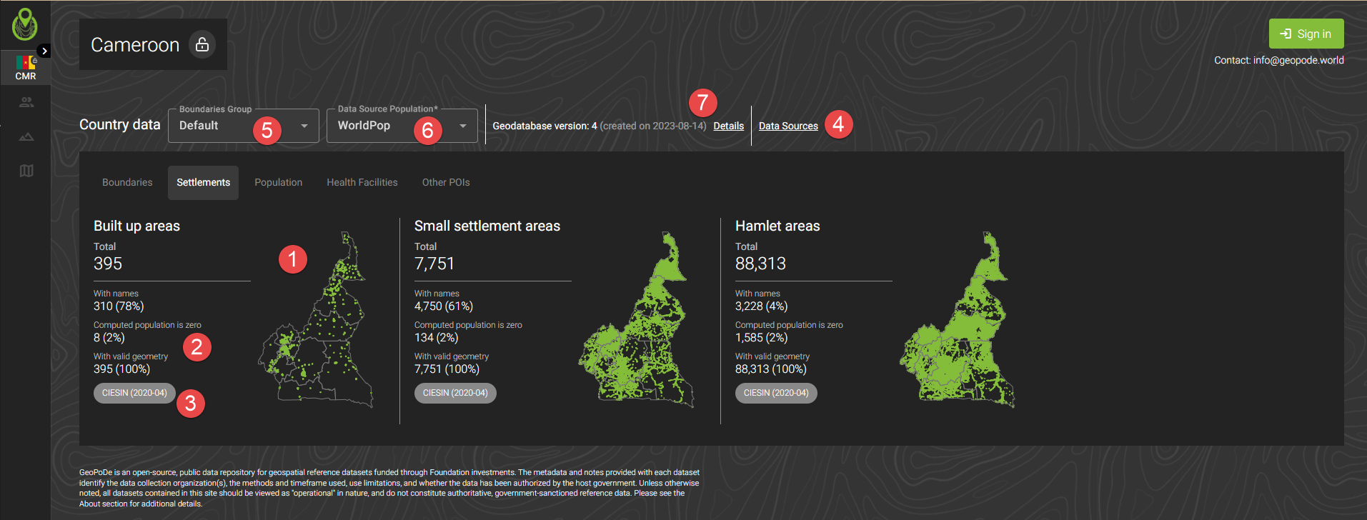
Versioning
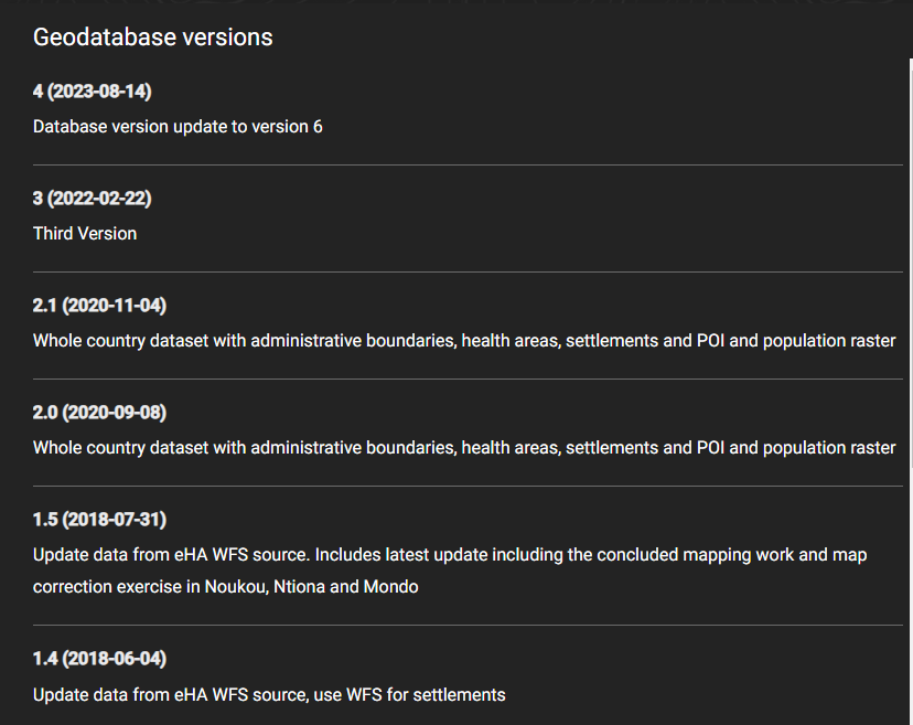
The geodatabase for a country is versioned and the version history is available here:
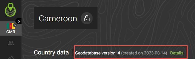
Clickin on ‘Details’ will bring up the version history:
Logged in
You can access the other pages from here (available only when logged in):
Population export (see Population export)
Geometry export (see Geometry export)
The map page (see Map tools)
These can also be accessed via the corresponding icons in the vertical menu.